For years, scientists have said that atmospheric rivers can either make or break the water supplies of thirsty California cities and farms.
For the last two winters, a steady succession of these giant “rivers in the sky” have dumped record-breaking and drought-busting precipitation across the state, while simultaneously causing catastrophic floods, landslides, and dangerous blizzards.
But now, new research has found that these recent atmospheric rivers pale in comparison to some of the monster storms that battered ancient California — a sobering revelation that suggests to some experts that the state could be revisited once again by such cataclysmic storms.
“Our findings show that atmospheric river activity exceeds what has occurred since instrumental record keeping began,” said Clarke Knight, a U.S. Geological Survey research geographer and the lead author on the study that detailed — for the first time — atmospheric river activity dating back 3,200 years. “This is important because it suggests the latent potential of our area to experience storms beyond those that we have seen today.”
Although few people had even heard of atmospheric rivers just a couple of decades ago, research into the mammoth vapor trails has proved critical to California water planning and public safety.
The study’s findings do not bode well for a state whose flood infrastructure was severely strained last year, when a train of atmospheric rivers breached numerous levees, flooded communities and re-filled once dry Tulare Lake. The findings also up the ante for state efforts to capture stormwater as climate change causes more precipitation to fall as rain instead of snow and ushers in a new era of more frequent and prolonged drought.
Knight and her fellow researchers arrived at their conclusion after analyzing ancient layers of mud from Leonard Lake in Mendocino County. The team was able to determine when more sediment had been pushed into the lake, indicating periods of higher precipitation.
Then, using data for atmospheric rivers over the last 60 years, the researchers found a “strong correlation” between their sediment findings and modern storms, allowing them to model that link through the rest of the mud layers to reconstruct historical atmospheric river activity, Knight said. Their research was published Thursday in the journal Nature.
The research provides the most historical context to date for the state’s rainfall variability, and found that the region “consistently registered extreme precipitation over a 3,200-year period.”

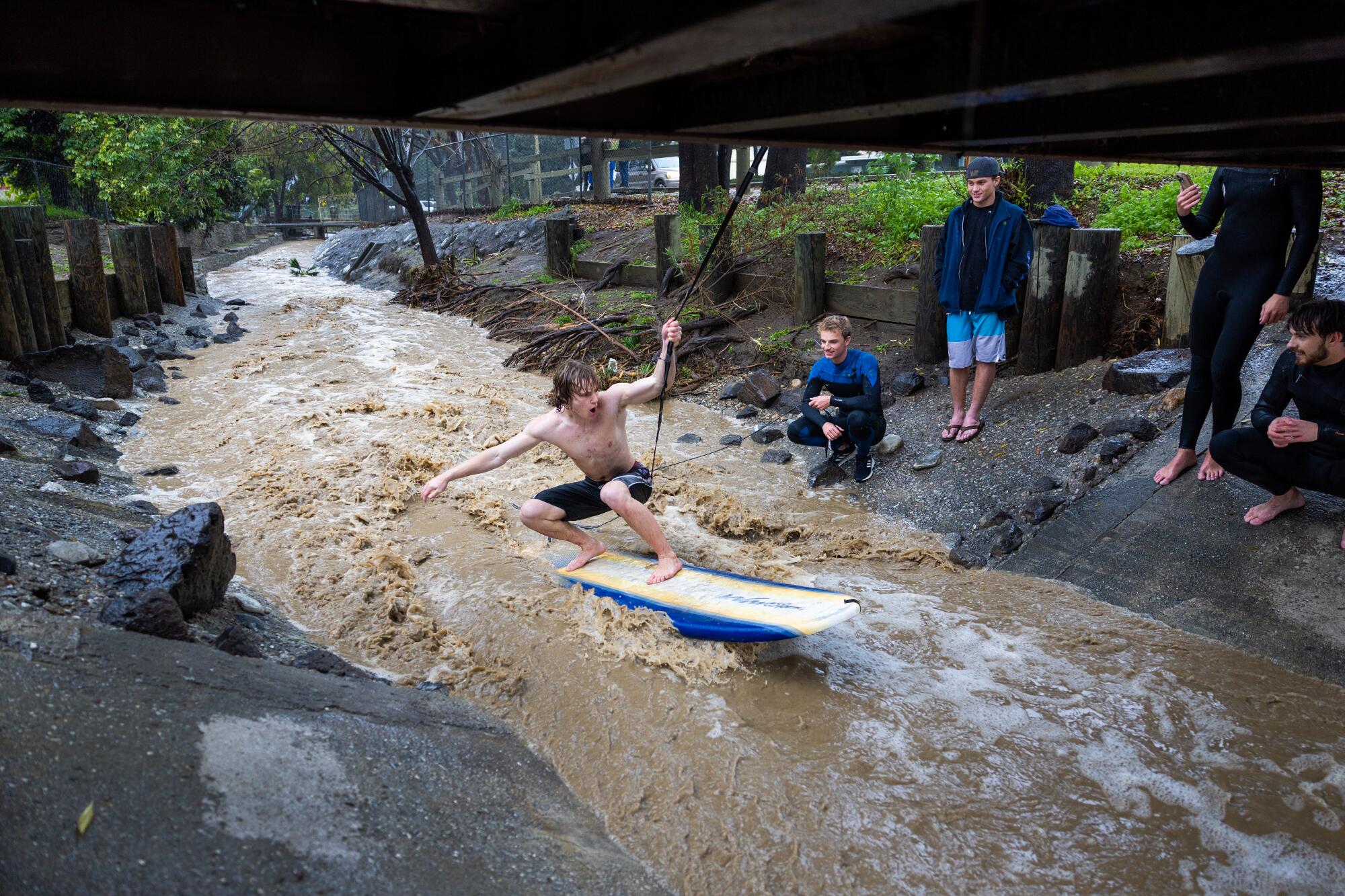
Biola University students take turns using a rope from a footbridge to stay in position and surf stormwater rushing through a La Mirada flood control channel after an atmospheric river unleashed heavy rain in La Mirada Creek Park.
(Allen J. Schaben / Los Angeles Times)
Knight said this new hydrologic data can better inform climate modeling and projections, providing a historical record 20 times longer than what’s been available.
Although the team’s research focused on Northern California — where the state typically sees the the most atmospheric rivers — she said it’s fair to conclude that the southern half of the state would have seen similarly extreme rainfall in its ancient climate given the widespread effects of large atmospheric rivers.
Previous research has shown that the average atmospheric river transports more than twice the flow of the Amazon River. The prospect of even larger storms hitting California is a concerning one, experts say.
Daniel Swain, a UCLA climatologist who was not involved in the USGS study, said the paper provides “direct physical evidence” of atmospheric river activity more extreme than anything seen in recent California history — well beyond the Great Flood of 1862, which reconfigured the state’s landscape.
He said the research “re-emphasizes the perils of assuming that the extremes we saw in the 20th century are representative of the kinds of extremes that are possible in this part of the world.”
“It’s an indication that — even if we didn’t have to contend with climate change — we should still be circumspect about the risks that are posed by extremes because we know that the climate system … can throw big, bad things at us periodically,” Swain said. “I don’t find that at all reassuring.”
The continuing climb of global average temperature due to humanity’s burning of fossil fuels also threatens to exacerbate matters.
“Adding energy into the system through greenhouse gas emissions is basically like shaking the soda can … and adding a little bit more energy into the system, allowing these extremes to be a little bit more extreme,” said Cody Poulsen, a graduate student researcher at the Scripps Institution of Oceanography’s Center for Western Weather and Water Extremes, who also was not involved in the Nature study.
Swain has posited that every degree increase in global temperature increases the risk of an “ARkStorm Scenario” — a once-in-a-thousand-years megaflood event. But these new USGS findings may indicate that worst-case-scenario modeling isn’t extreme enough, he said.

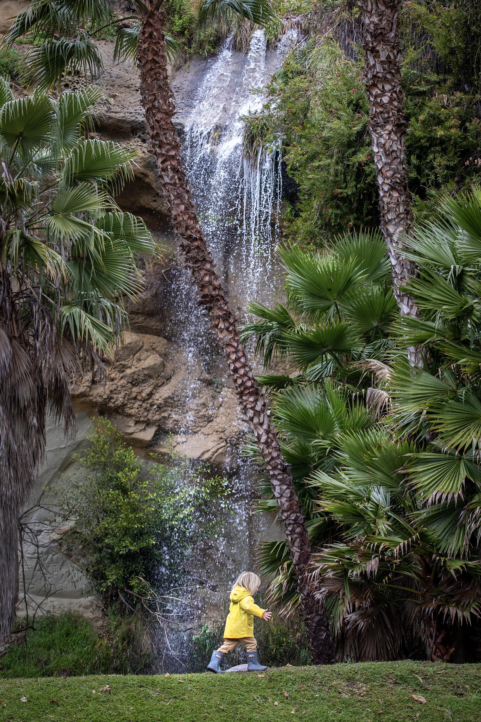
A child walks beneath the Dana Point Waterfall, which happens only when heavy rains occur, in March of 2023.
(Allen J. Schaben / Los Angeles Times)
For a state that is grappling with more frequent and severe periods of drought, the last two wet winters have come as a rare bounty. However, many Californians may be surprised to learn that these two wet seasons fall within the realm of natural variability. They may also be surprised to learn that this year has delivered more atmospheric rivers than the previous year, which caused far more damage and disruption.
Recently, researchers confirmed that 51 atmospheric rivers hit the West Coast during the 2023-24 rainy season — significantly more than the 38 atmospheric rivers that hit during the 2022-23 rainy season, according to new data from the Center for Western Weather and Water Extremes.
In California specifically, 44 atmospheric rivers made landfall from October through March, up from 31 during last year’s rainy season, said Chad Hecht, a center meteorologist.
But even though there were more atmospheric rivers this rainy season, fewer of the storms measured strong or extreme on the center’s strength scale compared to the season before that.
“It’s not the quantity, it’s the quality,” Hecht said.
For example, 12 strong, extreme or exceptional atmospheric river storms hit California between October 2022 and March 2023. These heavier storms tend to bring news-making rain and snow. This season, however, the state recorded only five.
“If you compare it to last year, … this [water] year was a couple of strong storms, but it’s a lot more weaker,” Hecht said. “But the abundance of weak-to-moderate [atmospheric rivers] kind of helped keep us on trajectory to hit that normal [precipitation levels].”
As of this month, records for both statewide precipitation and the snowpack across the Sierra Nevada stood at about 105% of average for this time of year — which Hecht called shockingly close to average.
“This year was abnormally normal,” Hecht said. “We like to talk about California being the land of extremes, where it’s either extremely dry or extremely wet. This year was abnormal because it was fairly close to normal through April 1,” the date that typically marks the end of California’s wet season.
However, Southern California has seen a more anomalous water year, with its yearly rainfall well over 140% of average across many coastal areas, according to the California Water Watch.
Hecht said one strong, slow-moving atmospheric river in early February had an outsized effect on the region’s rainfall, and he noted that many areas were also hit by thunderstorms during what he called “overly productive” weak atmospheric river storms.
The systems aren’t typically accompanied by thunderstorms, but several systems were this season, driving locally historic rainfall and flash flooding in several areas, including San Diego and Oxnard.
Hecht said it’s not immediately clear why so many atmospheric rivers this season included thunderstorms, but he said higher ocean surface temperatures — a signature of the El Niño weather pattern — could have helped spur the unstable convective pattern.
Even with many water measurements pointing to an overall average water year thus far, federal officials recently issued a major disaster declaration for nine counties after the deadly February atmospheric river storms.
Knowing that further rainfall extremes are possible, Swain said he hopes state officials can better prepare for emergencies, or at least better understand the possible risks.
“If we don’t correctly estimate the risk to begin with … it’s awfully hard to have an accurate discussion about costs and benefits of any particular intervention,” Swain said.
But, he noted that climate change is still expected to further stretch those natural extremes.
“It’s reasonable to interpret the 20th century as actually getting kind of lucky in California, in the sense that we didn’t see something worse … just through random, natural variability,” Swain said. “The 21st century? It’s a heavily loaded die.”

